Maps of Carigara

HOME
TABLE OF CONTENTS
Facts on Carigara
Carigara 400 et al
Fiesta's History
Fiesta Photo's
Maps of Carigara
Human Rights
Favorite Links
Trivia Pinoy
Mga Estorya
Founding Date
Torugpo
PHOTO ALBUM


Some of these maps are enhanced excerpts from the Carigara 400th souvenir program in 1995 and some from the Internet. The colored one on the bottom left is of the map at the corridor of the present LGU which I took in May of 2005. Click on pictures to enlarge image.

FACTS ON CARIGARA

Untitled Untitled Untitled Untitled


streets west to east

streets-north-to-south

tricycle3.jpg

carigara_map_color.jpg

map_carigara2.jpg

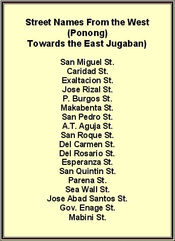
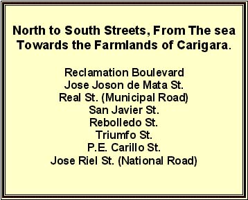
Click on the map for a close-up detail.

If by chance you have a better town map and
want to share it with your town mates,
I will gladly post it here in your credit.

This town map shows how big the
landmass of Carigara really is.

The 2 pinkish maps are from way back when a sand bar was evident in front of the now shoreline. Even I can not recall seeing them there during my adventurous younger days.

carigara_n_color.jpg

map_carigara3.jpg

mangoo3.jpg


TO TOP OF PAGE